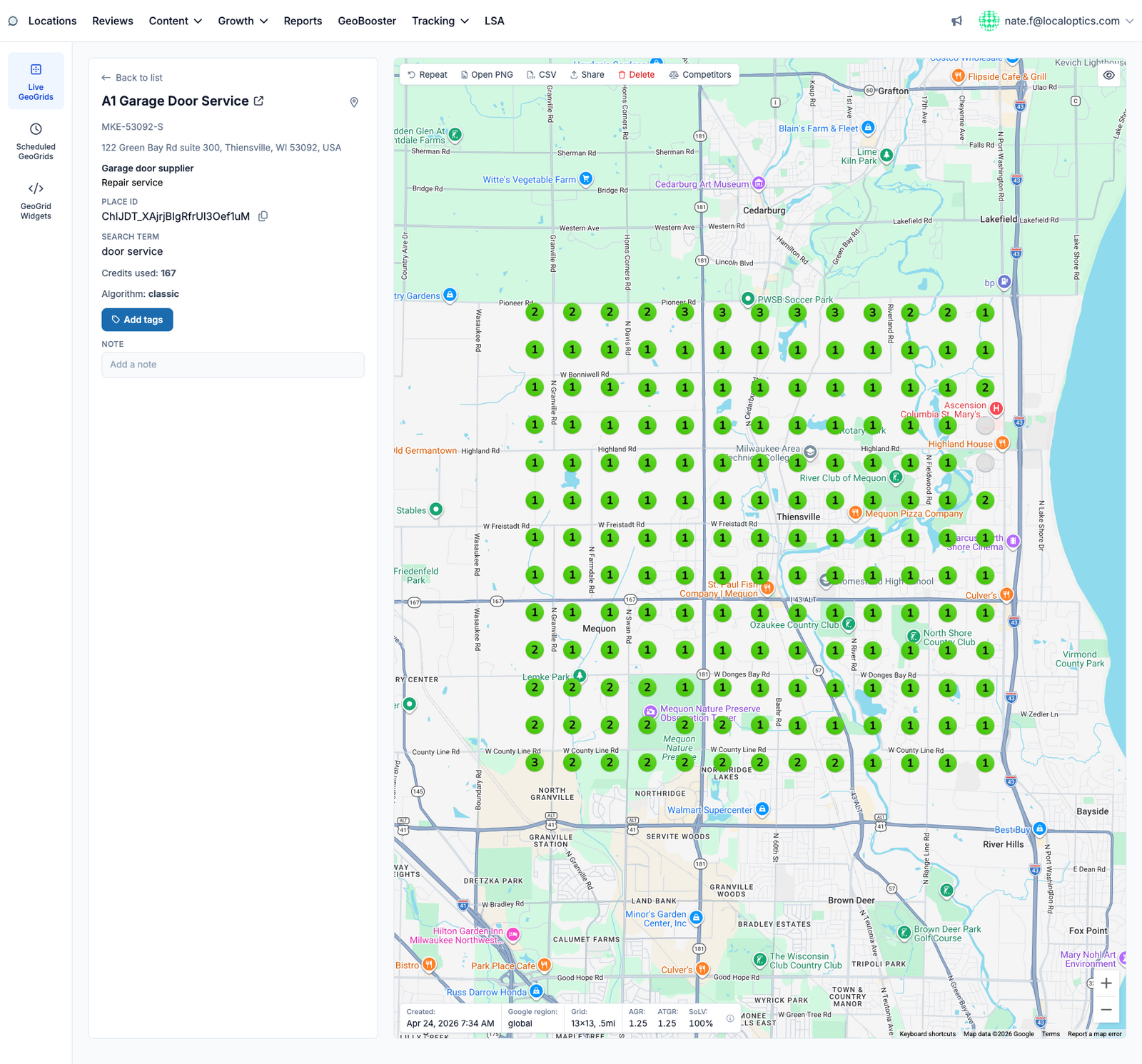
Live GeoGrids (GeoGrid Search > Live GeoGrids) are one-off, on-demand scans: pick a business, pick a search term, and get a rank map in minutes. Use them to spot-check a listing, size up a prospect, or verify the effect of a change without waiting for a schedule.
Running a scan
Click New GeoGrid and configure:
Business - one of your tracked locations, or any business by name or Place ID (great for prospecting).
Search term - the query to check.
Grid size - 3x3 up to 13x13 points.
Point distance - the spacing between points, from 100 meters to 25 km (or 0.1 to 10 miles) - tight spacing for dense cities, wide for service areas.
The scan costs one credit per grid point and results stream onto the map as each point completes.
The results page
Alongside the rank map and its AGR / ATGR / SoLV scores, the toolbar gives you:
Repeat - re-run the same scan now (handy after making listing changes).
Open PNG / CSV - download the grid as an image or the raw point data.
Share - generate a public link anyone can view without logging in.
Competitors - see which businesses hold the top spots at every grid point, and click one to re-render the whole grid from that competitor's perspective.
You can also tag the geogrid and add a note, so scans stay organized in the list view.
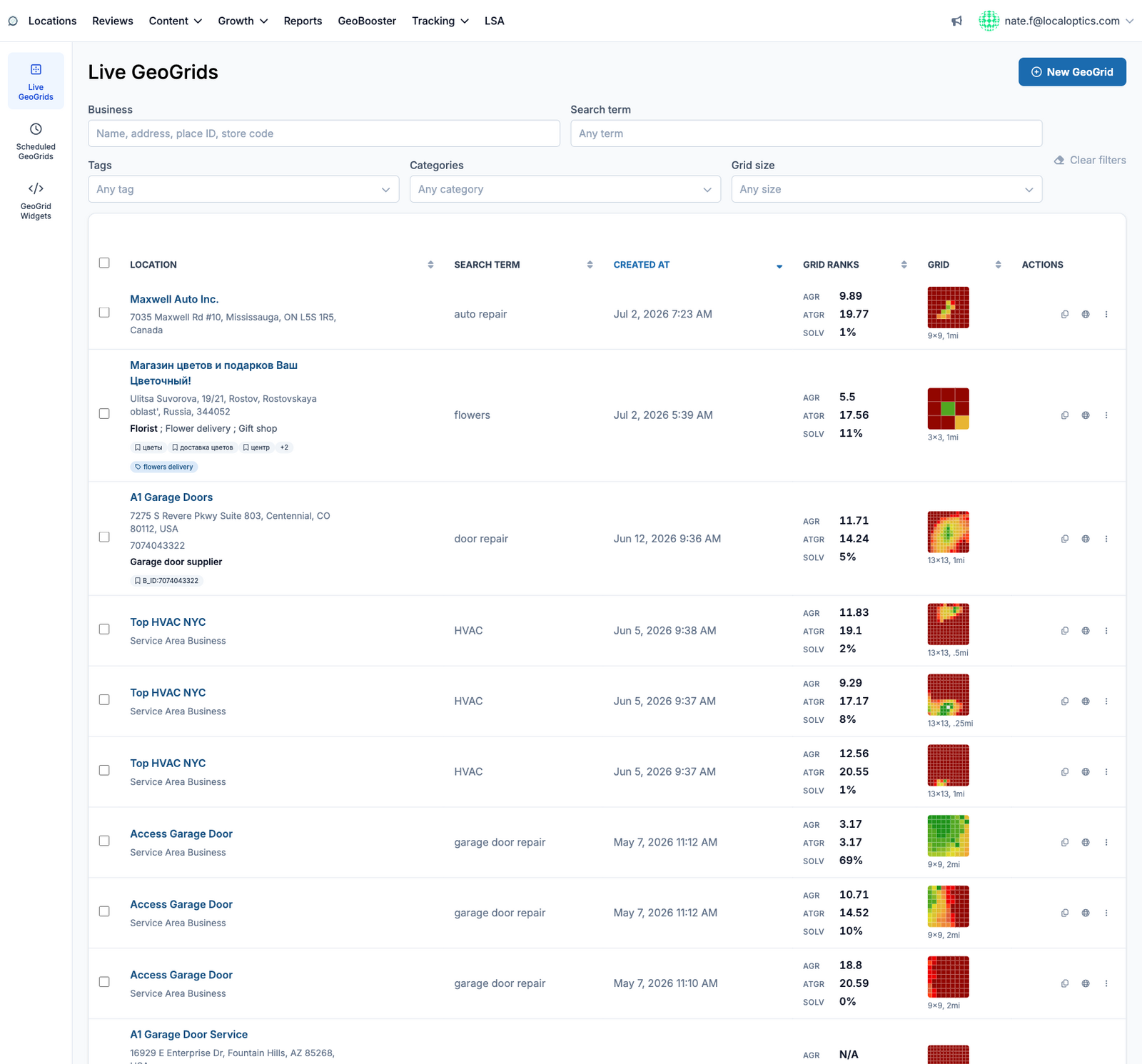
The list view
The Live GeoGrids index shows every scan with its business, search term, date, AGR / ATGR / SoLV and a color thumbnail of the grid. Filter by business, search term, tags, categories, or grid size:
And a completed live geogrid - toolbar on top, metrics and grid details along the bottom of the map: